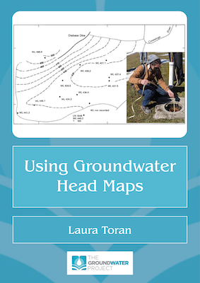
This book describes hydraulic head and groundwater flow with emphasis on plan view maps. All maps of groundwater flow tell a story about where the water is coming from and where it is going in an aquifer. Groundwater head maps are used extensively in environmental consulting, and one of the first steps in site evaluation is often to look for or produce a head map. However, sometimes these maps are made without strong knowledge of the underlying principles and sources of data. An understanding of how to identify recharge (source) areas and discharge (sink) areas in plan view is important for creating and interpreting head maps and is typically the first stage in producing plume maps that suggest directions of contaminant flow. This book provides exercises on constructions of groundwater head maps, sources of errors, interpretation of maps, and limitations in using maps to explain plume movement. When drawn and interpreted correctly, a groundwater head map helps us protect our groundwater resources.
Using Groundwater Head Maps

Number of pages: 82
978-1-77470-117-1
https://doi.org/10.62592/JXTR4167
Citation:
Toran, Laura. (2025). Using Groundwater Head Maps. The Groundwater Project, Guelph, Ontario, Canada. https://doi.org/10.62592/JXTR4167.
Author:
Laura Toran: Temple Univeristy, USA
Please donate to support us in providing free high-quality education to the global groundwater community.
Thank you,
John Cherry
Last Update: 29 October 2025
Released: 4 June 2025
65919
Using Groundwater Head Maps
1 file(s) 8.10 MB
65924
UsingGroundwaterHeadMaps-Exercise-1and2.xlsx
1 file(s) 12.61 KB
65928
UsingGroundwaterHeadMaps-Exercise-4.xlsx
1 file(s) 1.04 MB
65932
UsingGroundwaterHeadMaps-Exercise-4-Solution.xlsx
1 file(s) 1.78 MB
65936
UsingGroundwaterHeadMaps-Exercise-6-Solution.xlsx
1 file(s) 203.93 KB
Description
Interview with the Author
Thank you for signing up to our email list!
Contents
1 PURPOSE AND RELATIONSHIP OF THIS BOOK TO OTHER BOOKS IN THE SERIES
2 HEAD, POTENTIOMETRIC SURFACE, AND FLOW LINES
2.1 Wells and Head Measurement
2.2 Potentiometric Surface (Head Contours)
3 USING POTENTIOMETRIC SURFACE MAPS TO ILLUSTRATE A GROUNDWATER FLOW SYSTEM
3.1 Common Contour Patterns
3.1.1 Recharge Patterns
3.1.2 Discharge Patterns
3.1.3 Horizontal Flow Zone Patterns
3.2 Cones of Depression Patterns
3.3 Geologic Boundary Patterns
3.4 Overview of Contouring Groundwater Head Maps
4 MAPPING PLUMES AND LIMITATIONS TO PLUME DELINEATION WITH HEAD MAPS
5 WRAP-UP
6 EXERCISES
Exercise 1: Measuring Head in a Well
Exercise 2: Finding The Open Interval in a Well
Exercise 3: Heads in Multi-Level Wells
Exercise 4: Variation in Head Over Time (Using Usgs Monitoring Wells)
Exercise 5: Relating Head to Contour Maps
Exercise 6: Contouring with Only 3 Measurements (3-Point Problem)
Exercise 7: Contouring Near Stream Discharge Areas
Exercise 8: Flow Lines Near a Lake
Exercise 9: Interpreting Contours in a Multi-Layer System
Exercise 10: Identifying Recharge and Discharge Areas from Contours
Exercise 11: Contouring a Cone of Depression Near a Boundary
Exercise 12: Identifying Errors in Head Contouring
Exercise 13: Estimating Plume Shapes from Groundwater Contours
Exercise 14: Evaluating Hazardous Waste Site Cross Section and Groundwater Head Maps
7 REFERENCES
8 EXERCISE SOLUTIONS
9 ABOUT THE AUTHOR
Thank you for signing up to our email list!
